
Rocks don’t go far
By Leslie Spencer
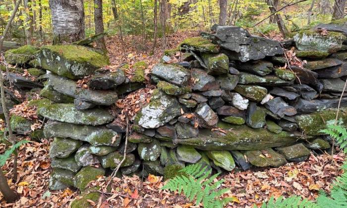
I knew it was going to be a great day when our only instructions were to rendezvous at a dropped pin and to bring a lunch.
Last weekend, we had another Vermont Master Naturalist adventure, this time, to learn about the cultural history of a Vermont landscape with Sam Ford. Sam’s superpower is piecing together the story of a place by reading the landscape features as well as diving deep into historical documents – deeds, newspaper articles, etc. Together, we explored a former “hill farm” in Berlin, Vermont, that is now hidden in the town forest.
For context: many of Vermont’s early settlers established farms in the hills, where making a living meant relying on what the land could provide. People built their homes with local materials, plowed rocky fields with animal power, and were subsistence farmers – growing food largely to feed themselves, not much to sell.
Throughout the day with Sam, we pieced together the story of why it had become so difficult to make a living up on this hill, and why the farm is now being reclaimed by the forest. Something that amazed me about our day in the woods with Sam, was how many stories we can learn based on patterns of how these hill farmers used stone. For example…
Stone box culverts
We had barely made it 100 feet up the trail when we stopped at our first attraction of the day: stone box culverts, constructed to let streams pass beneath the road. Based on how these culverts were built, we have evidence that people have been using this corridor for transportation for about 200 years. This lines up well with our hill farm story… the first records of the family that settled here were from the 1790s.
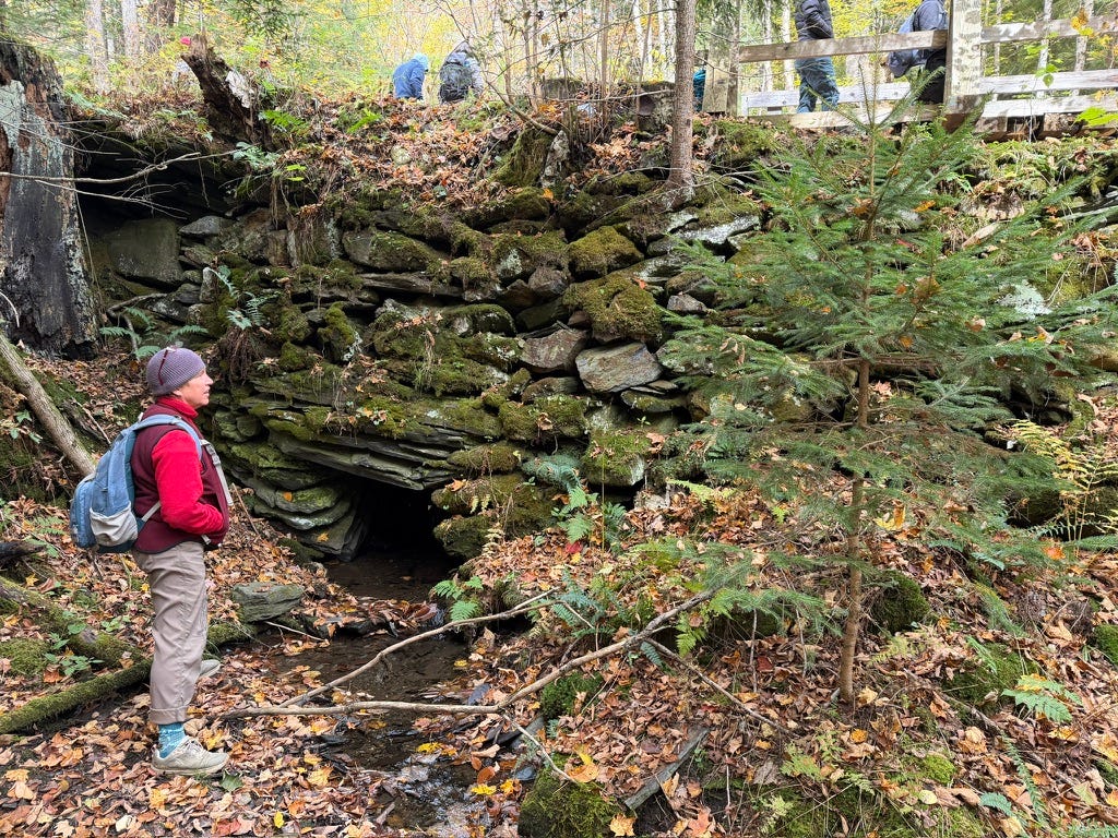
A stone box culvert.
These culverts would have been made from local stone, probably the bedrock (Waits River Formation). The hill farmers would not have been hauling in stone from elsewhere when they already had building materials in their landscape.
Today, culverts are often made form corrugated metal pipes. While this kind of culvert is less labor intensive to construct, they need replacing every couple of decades. And, depending on the construction, they can also cause significant erosion of the stream bed and impede fish passage. Stone box culverts are generally stronger and they help maintain the natural stream bed.
It’s amazing that, around 200 years later, these stone box culverts persist even after facing many major flood events. While we did see some evidence of culverts collapsing and needing repairs over the years, they are still fairly intact, telling us a story about past era of Vermont. I appreciated how Sam incorporated culverts into the story of this hillside, because they are something that I could have easily overlooked.
Stone walls
I’m no stranger to stone walls… I grew up in Stonington, CT, where stone walls dot the landscape. I knew the general story: that farmers piled stones on the edges of their fields as they cleared and plowed. But last weekend, I learned so much more from Sam about how stone walls can tell the story of a place.
Stone walls did not necessarily mark property boundaries; instead, they would usually divide different land uses within a farm. At one spot, we learned about how the stone wall once divided pasture for livestock from fields used to grow crops.
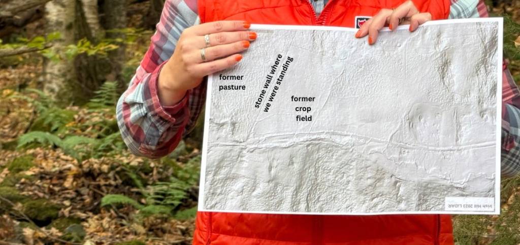
Sam holding up a LiDAR map, that I annotated. Former pasture (dimpled land) on the left of the stone wall and former crop field (flat land) on the right.
Like an X-ray scan, LiDAR maps allow us to see the terrain of a place beneath the trees. This is especially useful here: the farm was abandoned and the land is returning to forest, so it can be a challenge to envision what this landscape looked like when it was once a working farm. On the right side of the wall, we see on the LiDAR map that the land is very flat, indicating that it was plowed for crops and stones were removed year after year. On the left side of the wall, the land is dimpled. This field was once cleared of trees, but not plowed, as it was used as pasture for livestock.
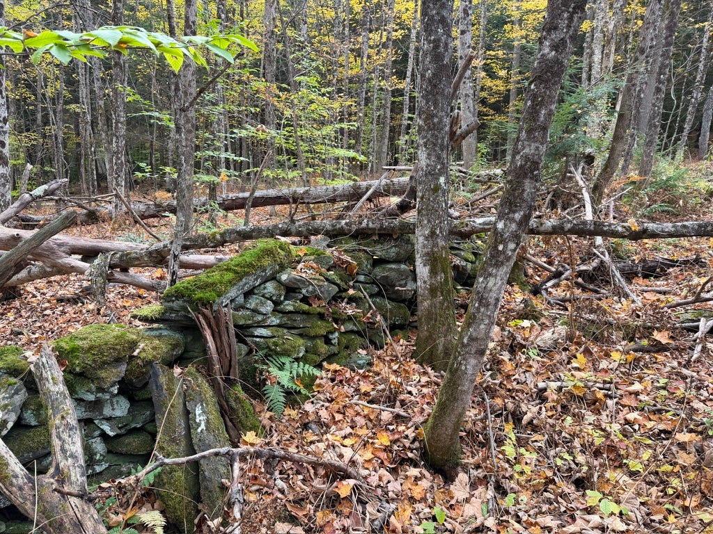
For reference, this is what we were looking at in the woods: former pasture on the left side of the stone wall and former crop field on the right. It’s hard to tell the difference without the clues from the LiDAR map, as it’s all turning back into forest today.
Again, part of Sam’s magic is how she learns the story of a place by knitting together physical landscape features and historical documents. For example, she also had a copy of the 1860 ag census, which added to our understanding of this family’s life and what was going on in these fields: they had horses, oxen, cows, and sheep, and grew wheat, corn, oats, hops, and more.
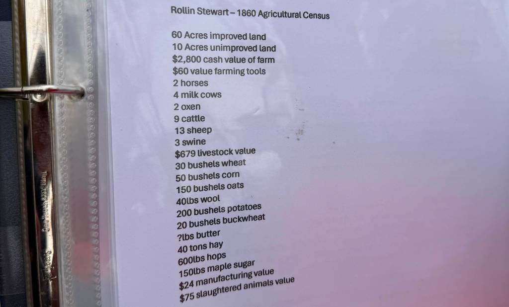
1860 ag census from this hill farm.
Two other fun stone wall stories:
1. The family that settled on this hillside was Irish, and with them, came potatoes. To grow potatoes, you had to to remove all rocks from your fields of a similar size to a potato. Stone walls that were next to potato fields often contain small, potato-sized rocks.
2. Most often, we see one stone wall. But what does it mean when you see two stone walls, parallel, and close together? A cow chute! These were used to corral cows from one place to another, for example to move them between an upper and lower pasture on a hill farm.
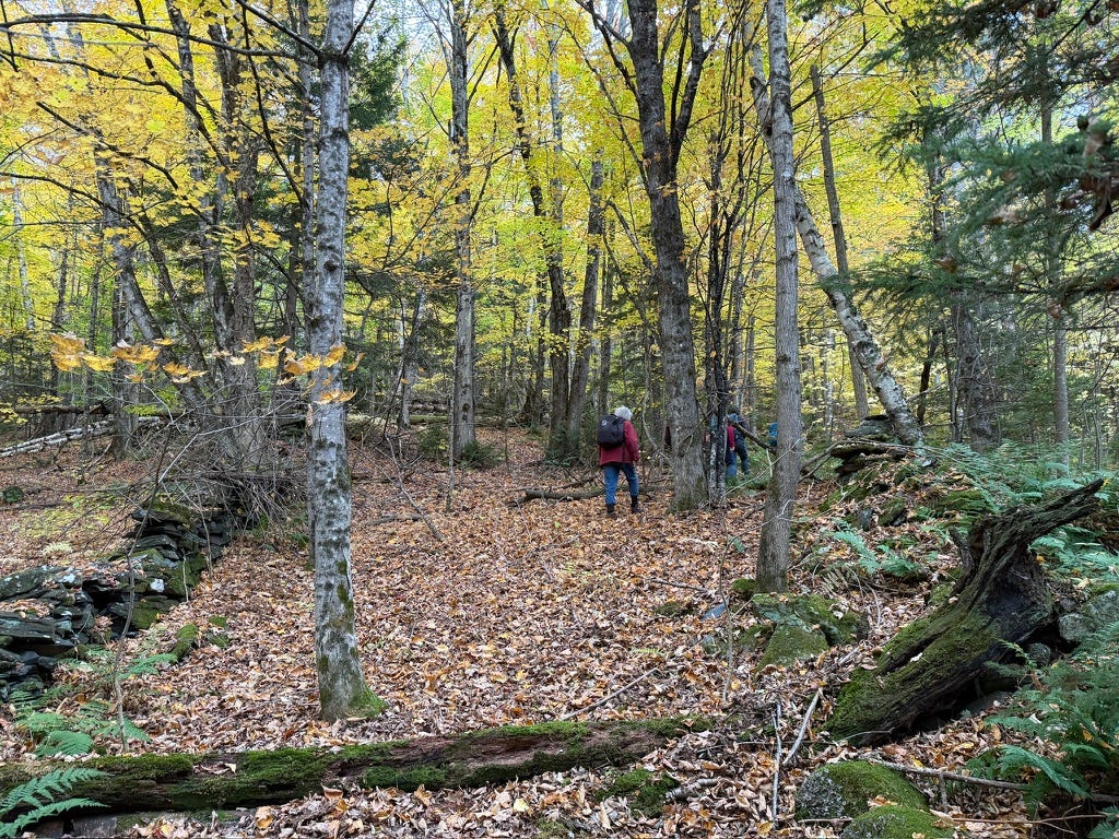
Two parallel stone walls = a cow chute!
Stone foundations
In these woods, we also had the chance to explore the foundations from two abandoned homes. From the materials and construction, and cross-referencing with historical documents that Sam has found (e.g., early deeds), we know that both foundations were central chimney cape houses built around the 1790s.
Early New England settlers built this kind of home, using local materials (again in this case, likely Waits River Formation bedrock). At the center of these houses was a large chimney, and a central fireplace helped keep the families warm through cold Vermont winters. Under the house, a root cellar provided a space to preserve food throughout the year. It was important that the fireplace was high enough that it kept the living space warm but did not warm the root cellar and spoil the food.
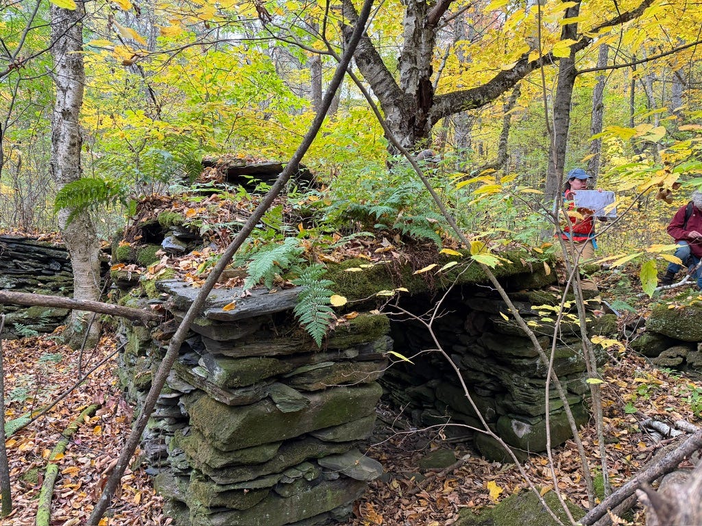
View of the root cellar and chimney support structure at one of the foundations we visited.
The local stone that made up most of the foundation was not the only clue that helped us date these homes. We also found handmade bricks that were full of imperfections, which are also a sign of late 18th century Vermont construction. For example, one of the bricks look like it had burst in the middle – evidence that it was probably too wet when it went into the kiln – but clearly the family still used it in their chimney, showing how valuable these local resources were to them at the time of construction. Another brick had traces of cement from a later repair, suggesting that the chimney was maintained and repaired over generations.
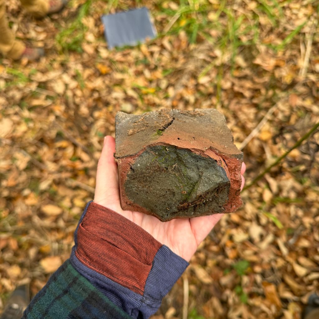
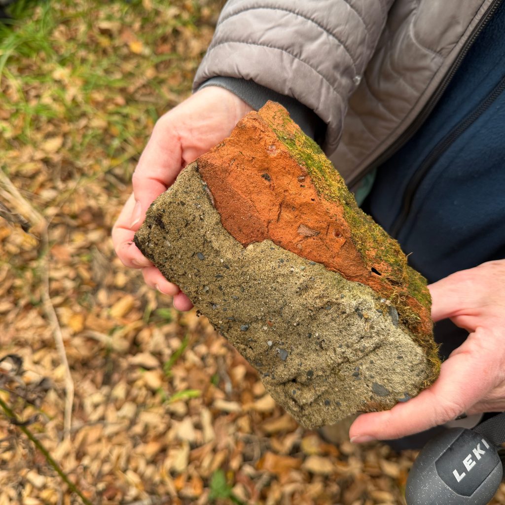
A brick with signs of rupturing in the kiln (left) and a brick with signs of later repair (right).
We also stumbled upon some ornamental plants in the woods, reminders of how different this landscape once looked. Daylilies growing near one of the foundations persist today, despite this house being abandoned around 75 years ago. A Norway spruce also towered overhead. With the spruce, we hit the jackpot, in that Sam found a historical photo showing the same spruce as a baby tree outside of the former home, over 100 years ago.
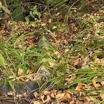
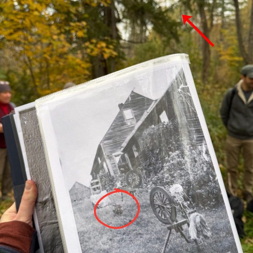
Daylilies from a past life of this hillside (left) and baby Norway spruce (circled in red) with today’s 100+ Norway spruce in the background (red arrow; right)
Why was this hill farm abandoned?
Hill farms declined as Vermont agriculture changed. Dairy farming started to boom in the valleys, where better soils and easier access to transportation made it easier to specialize and modernize. Shifting from subsistence farming to specialized dairy production, for example, meant getting milk down from the hills and into town. Even if a hill farm could support more cows, the logistics and cost of transporting that milk made it impractical. As the dairy industry grew and grew, many hill farmers were left behind. The family that started this farm left in the 1950s, after six generations, because it became too hard to keep up with changing agriculture.
Today, Vermont dairy farmers are facing very similar pressures that hill farmers once faced. As the industry continues to consolidate and modernize (think, robot milking systems, for example), small farms are going out of business at a staggering rate. I’m noting this just to say that when we build a food system around maximizing profits, many people get left behind and have to leave their land, as power and money concentrate in fewer hands… but that’s a story for another day (or check out Gibbs’ Substack for more on current Vermont challenges).
At the end of our day with Sam, we went around in a circle noting something that we’d remember from our time in the woods together. One person said it so simply: “rocks don’t go far.”
That sums up our day so well: you can learn so much about the story of a place in New England – both social and ecological – by paying attention to the stones.
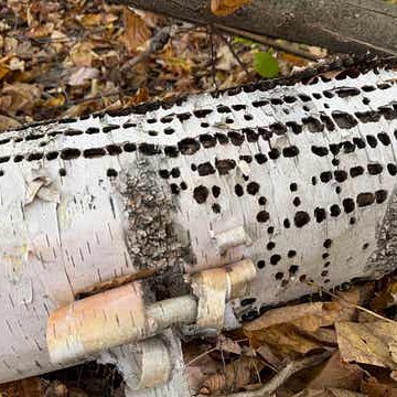
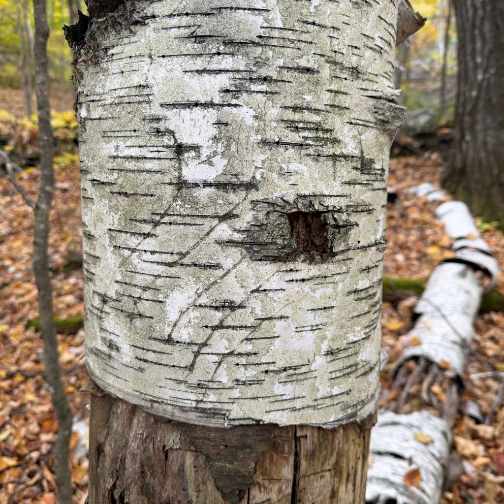
Alongside the stories from stone, the trees had stories to tell, too: a yellow-bellied sapsucker (left) and a black bear (right) also call this hillside home.
🐝 Thank you for being here! In Bee Curious, you’ll find nature notes peppered with personal reflections and stories, often with a pollinator slant. This is a space for sharing and sparking curiosity about the natural world, especially bees. Feel free to share this post with a friend!
All photos are my own unless otherwise noted.
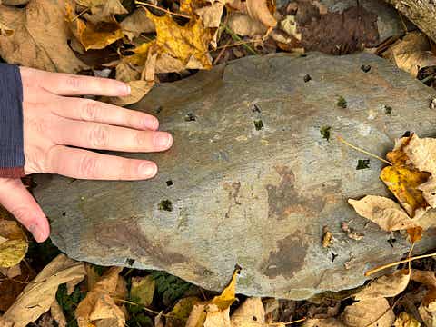
Waits River Formation Bedrock with holes where pyrite, aka “fool’s gold,” used to be.
This post was originally published here.

